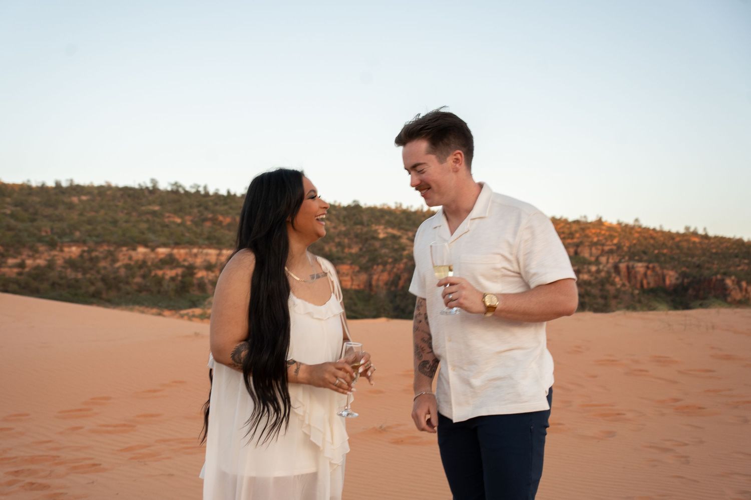
Picture this: red sandstone glowing orange, the Colorado River cutting through canyon walls below you, and the two of you completely alone at the exact second everything changes. That’s not a stretch for Moab. That’s a Tuesday morning at Corona Arch if you time it right.
Moab isn’t one proposal spot. It’s a whole basecamp of them: Arches, Canyonlands, Dead Horse Point, and a stretch of BLM desert in between, all inside about a 30-minute drive of downtown. Which one is right for you comes down to how much hiking you want, how much company you can tolerate, and how badly you want that classic red-rock-arch photo everyone recognizes.
Here’s the part that catches most out-of-state couples off guard: the biggest planning decision isn’t the trail, it’s the land. Corona Arch sits on Bureau of Land Management ground, so there’s no Special Use Permit, no fee, and no application to wait on. Arches and Canyonlands are national parks, so a proposal itself still needs no permit there either, though summer heat and crowds matter more than any paperwork will. Dead Horse Point is the outlier: a $20 day-use fee, and a Special Use Permit only if you’re planning an actual ceremony there, not a proposal.
Every photo of an actual proposal on this page is from a couple I’ve photographed in Moab, not a stock stand-in. I’ll tell you plainly, spot by spot, which ones I’ve documented and which ones I haven’t gotten to yet.
TL;DR
8 spots covered here: Corona Arch, the Windows/Double Arch, Delicate Arch, Dead Horse Point & Canyonlands, Fisher Towers, Potash Road, the La Sal Mountains, and Moab Rim.
Corona Arch and most BLM spots: no permit, no fee, no wait.
Arches & Canyonlands National Parks: $30/vehicle entrance, no permit needed for a proposal, no 2026 timed-entry reservation as of this writing.
Dead Horse Point State Park: $20/vehicle day-use fee; a Special Use Permit is only required for an actual ceremony, not a proposal.
July highs regularly top 100°F, so build your timing around sunrise or the last hour before sunset.
Proposal photography starts at $845, with travel added for Moab since it’s outside the standard hour-of-Wasatch-Front radius.
Why Moab Is Worth the Drive
Moab solves a problem most proposal locations create: it gives you options without forcing a compromise.
Most couples flying into Utah for a proposal have to pick one park, one trail, one look, and hope it matches what they pictured. Moab hands you an entire menu instead. Arches for the classic sandstone-arch photo everyone recognizes. Canyonlands and Dead Horse Point for a sheer canyon overlook with the Colorado River a thousand feet below. Corona Arch, Fisher Towers, and Potash Road for red rock that doesn’t come with a national park entrance line. The La Sal Mountains for green alpine meadows fifteen minutes from a desert floor that hits 100°F in July.
That range means the spot gets built around your partner, not the other way around. An adventurous couple who wants a hike built into the moment gets Fisher Towers or Corona Arch. A couple who wants maximum drama for minimum walking gets the Windows region or Dead Horse Point, both an easy stroll from the parking lot. A couple set on total privacy gets Potash Road at sunrise, when the whole canyon belongs to you.
It also photographs like nowhere else in the state. Sandstone that shifts from rust to gold to deep orange as the sun drops, natural stone arches that frame a moment better than any backdrop I could build, and a sky big enough to make two people look small in the specific way that makes a proposal photo land.
And because so much of the land around Moab sits outside a national park boundary, on Bureau of Land Management ground like Corona Arch, Fisher Towers, and most of Potash Road, you get that backdrop without the red tape that comes with a park. No Special Use Permit application. No processing time. No fee. Your booking timeline runs on my calendar and your travel dates, not a government office’s turnaround time. That’s a meaningful advantage if you’re planning this from out of state on a tight trip window, and it’s one most couples don’t realize until they start comparing Moab to somewhere like Zion or Bryce, where a wedding-day permit process, still not required for a proposal, but worth knowing about, adds meaningful lead time.
Tell Me Your Travel Dates
Give me your dates and what you’re picturing, hike or no hike, big arch or quiet overlook, and I’ll send back the spots that fit before you spend another weekend scrolling geotags.
The Challenge With Planning a Moab Proposal From Out of State
Here’s what stresses couples out about planning this from far away: you’re trying to make a once-in-a-lifetime decision about a place you’ve never stood in, based on photos other people took in different light, at a different time of year, with no way to check yourself before you land.
Add up what that costs you. Hours scrolling Instagram geotags trying to guess which arch is which. More hours cross-referencing park alerts for a timed-entry system that changes year to year. A group chat with your best friend debating whether Corona Arch or Delicate Arch is “the good one.” A nagging worry that you’ll pick a spot, fly out, and find it packed with a dozen strangers and their dogs at the exact minute you planned to get down on one knee. That’s easily a full weekend of research for something you only get one shot at.
I’ve hiked every trail on this page more than once, scouted them at different times of day and different seasons, and photographed proposals at more than one of them. When you tell me your travel dates and what you’re picturing, hiking, easy overlook, big classic arch, total privacy, I can tell you in one conversation which spot fits, not which one has the most tagged photos.
I know which trailheads fill up by 8am on a Saturday in April. I know which overlook catches first light and which one holds golden hour longest. I know the cover story that gets a couple to Corona Arch’s cable-assisted ledge without tipping off your partner, and I know when to skip a spot entirely because the light or the crowd won’t cooperate that day.
You don’t need to become a Moab expert before your trip. You need one conversation with someone who already is.
Best Spots to Propose in Moab: 8 Options
Eight spots, eight completely different experiences. Here’s the full depth on each one: distance, difficulty, permits, best time of day, and the plain tradeoffs, not just a highlight reel.
Corona Arch: The One I Shoot Most
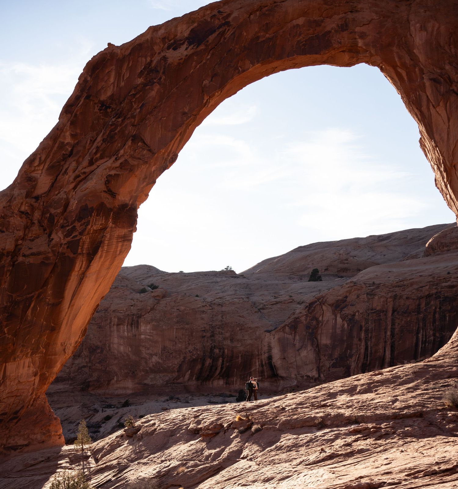
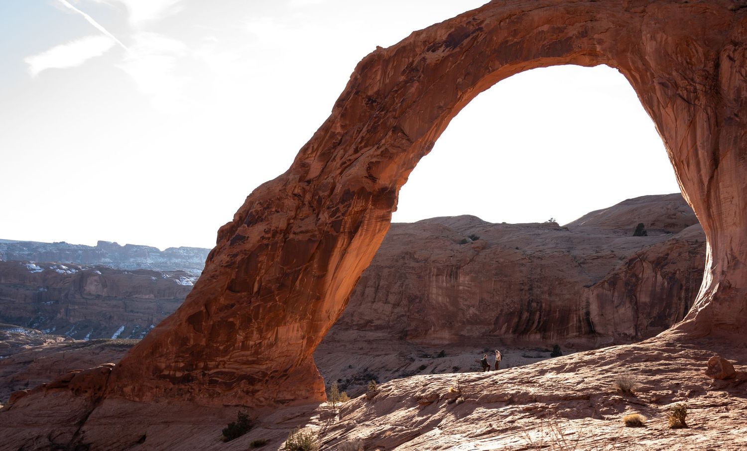
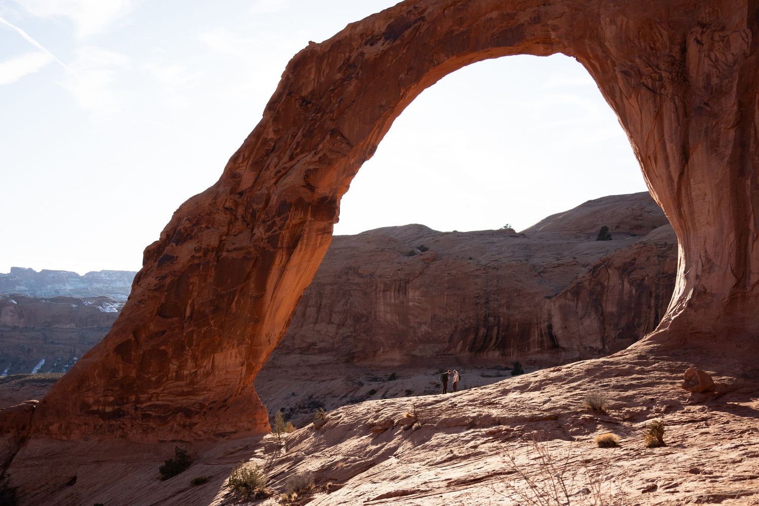
If I had to send every couple to one spot in Moab, it’s Corona Arch. It’s the spot in nearly every “best of Moab” photo you’ve seen, and it earns that reputation.
Corona Arch sits on Bureau of Land Management and city land off Potash Road (UT-279), about 10 miles south of Moab. The BLM took ownership of it from the state in 2014 and named it a National Recreation Trail in 2018, which is a fancy way of saying: no national park boundary, no park entrance fee, no Special Use Permit standing between you and booking it.
The hike itself is a moderately strenuous 3-mile round trip. It’s not a stroll, but it’s not technical either: a couple of sections use a steel cable and a short ladder to help you up slickrock, and neither requires climbing experience. Budget 90 minutes to 2 hours round trip if you want time to be at the arch, not just pass through it.
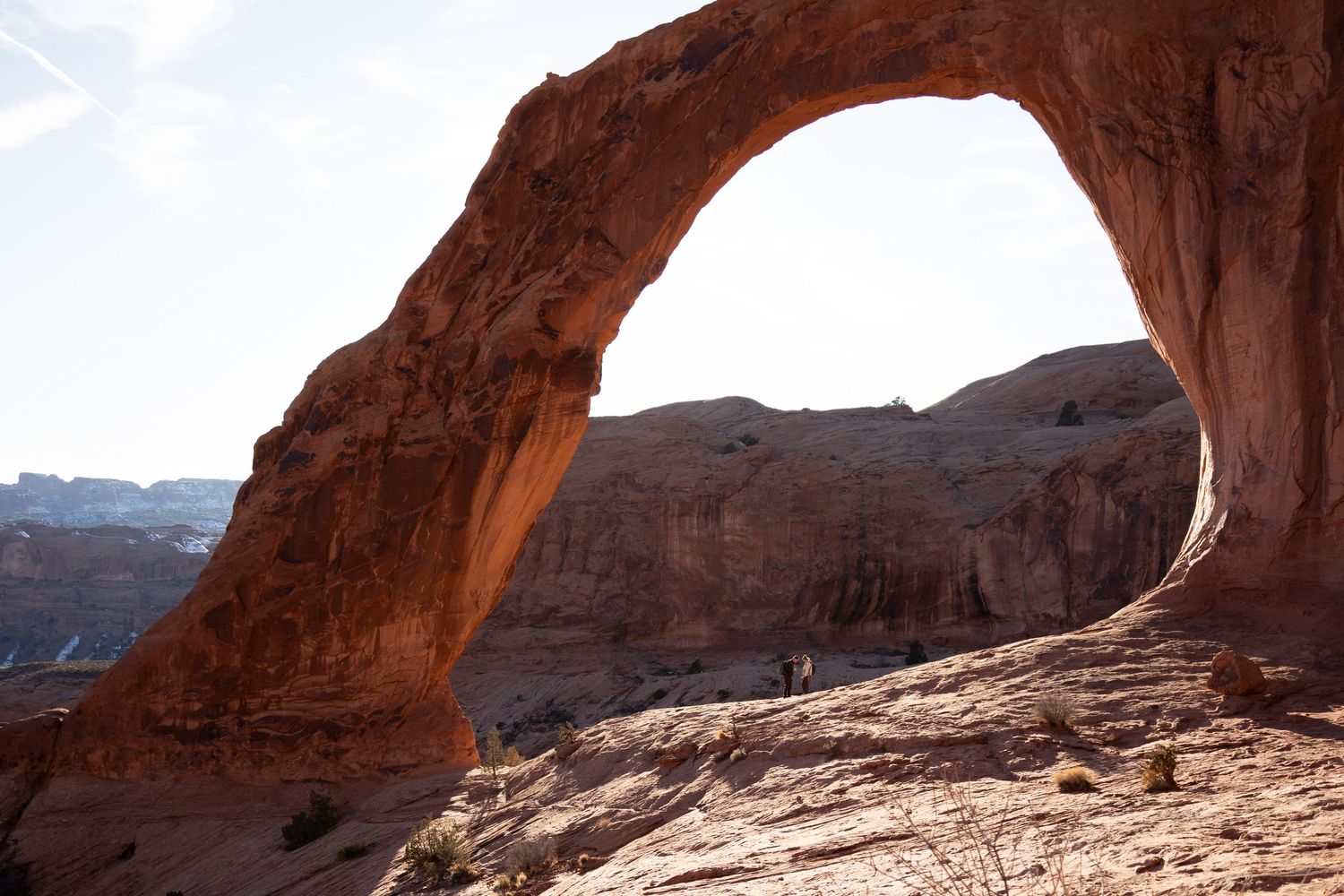
The arch itself is the payoff: a freestanding sandstone span roughly 105 feet wide and 140 feet tall, big enough to frame both of you with canyon walls stacking up behind. Morning light hits it clean and even; late afternoon into golden hour turns the whole formation orange-gold, which is why I book most Corona Arch proposals for the last two hours before sunset.
One detail that surprises almost everyone: BLM land generally allows recreational drone flying under standard FAA rules, unlike every national park, which bans it outright. If aerial footage is part of your vision, Corona Arch is one of the more flexible spots in the state to get it.
Corona Arch is also where I keep a proposal a complete surprise most often. It’s popular enough (about 80,000 visitors a year) that one more person on the trail with a camera never looks out of place. I hike up ahead of you, set up along the route like just another hiker, and shoot from a distance until you’re already down on one knee.
The tradeoff: because it’s popular, you’re rarely fully alone there. If total privacy matters more to you than the iconic look, Fisher Towers or a Potash Road pull-off further down this page might fit better.
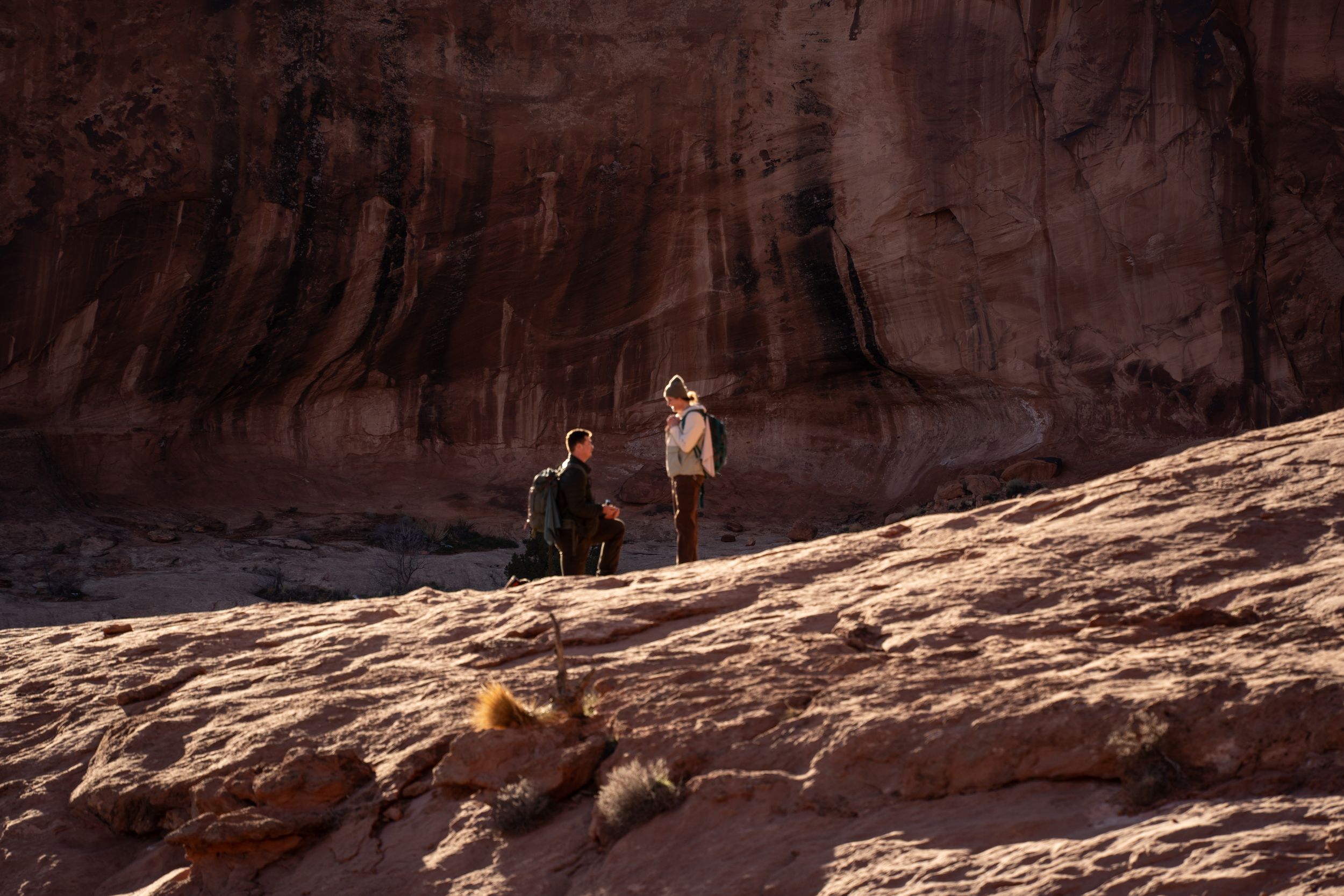
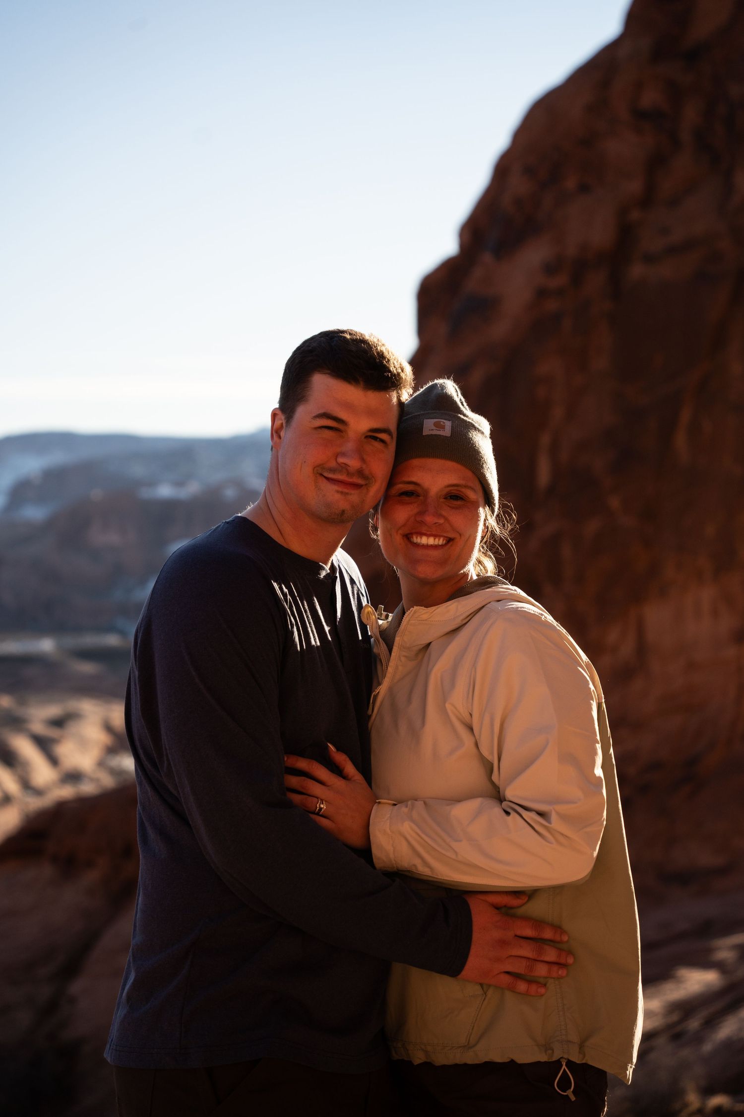
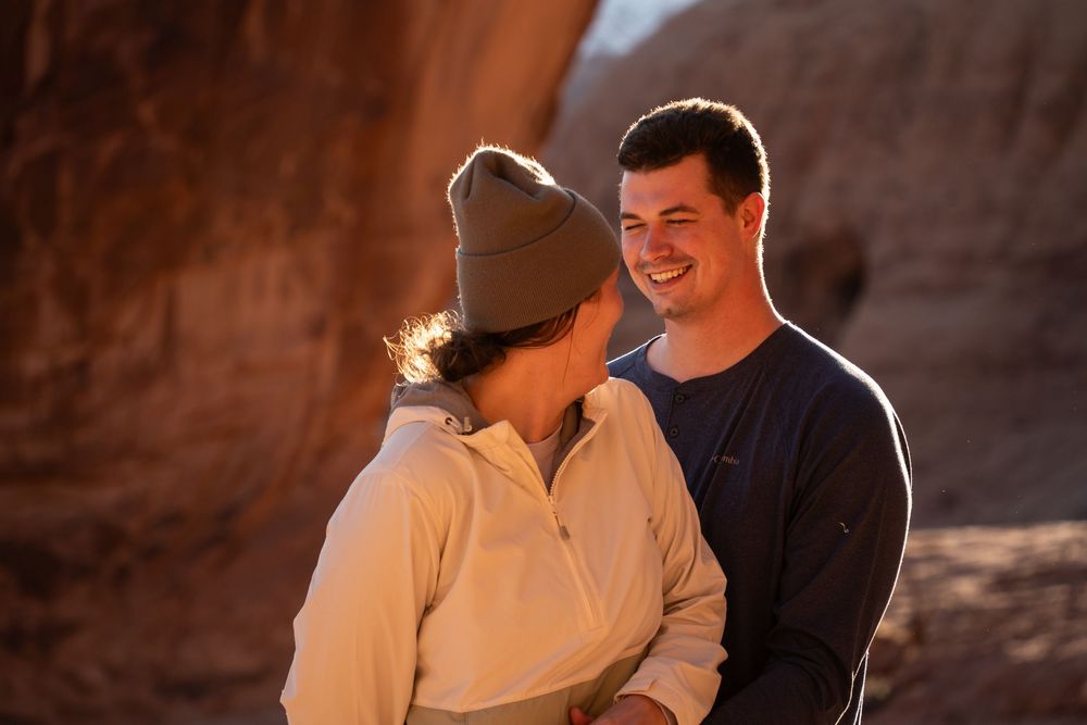
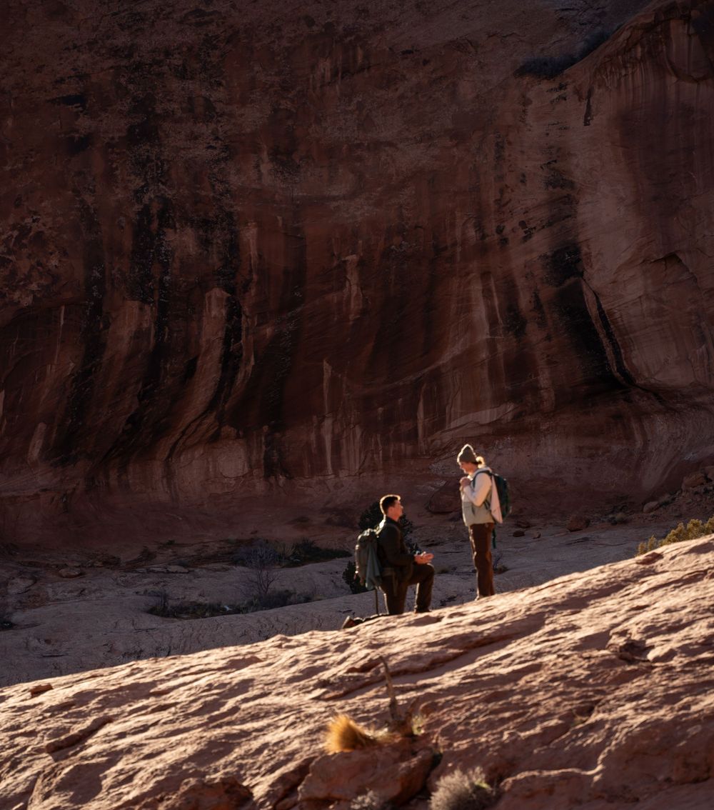
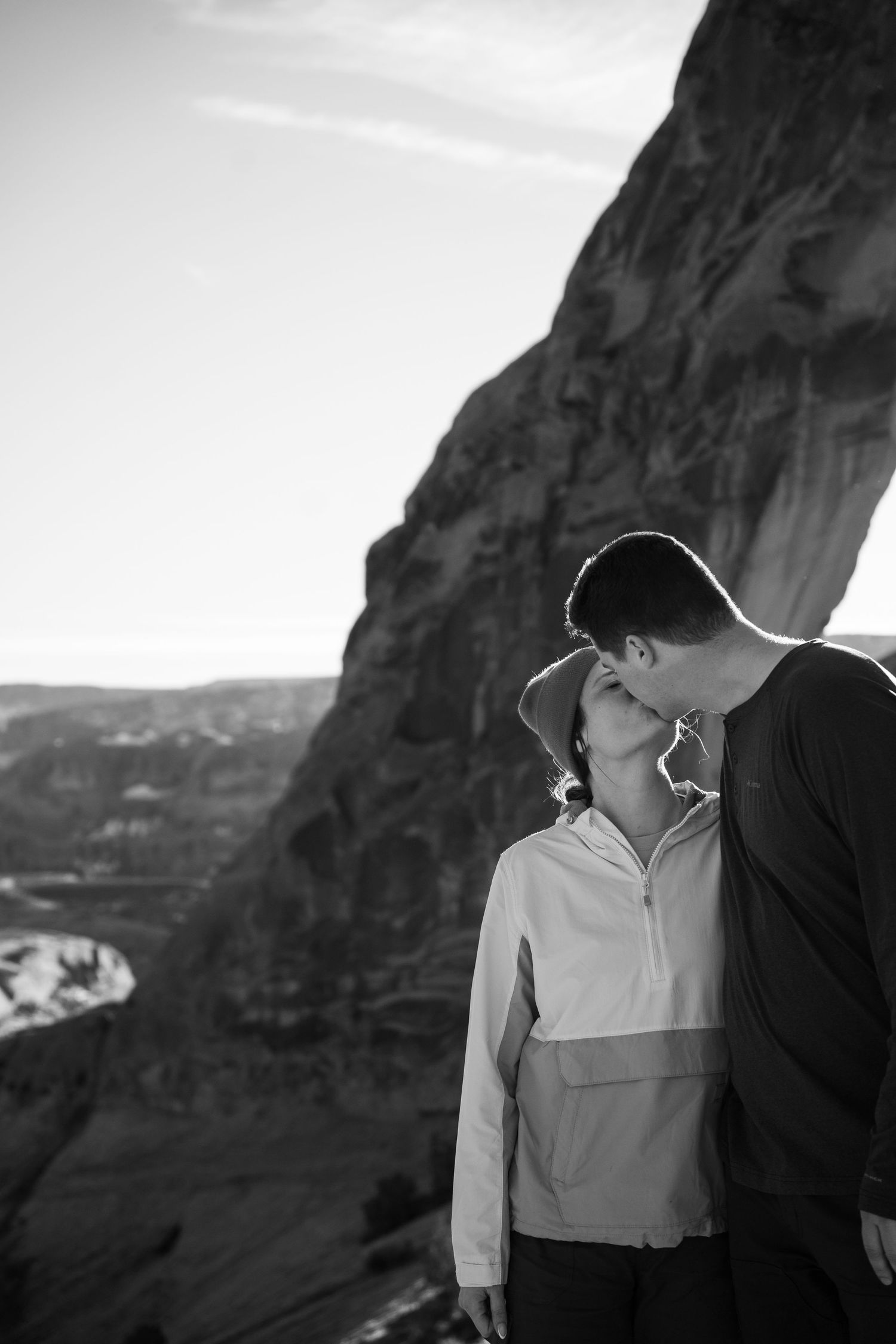
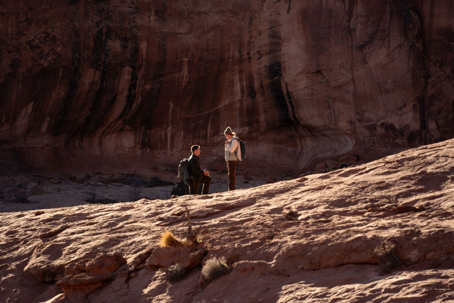
Jacob planned his Corona Arch proposal two weeks out during a trip from the Midwest, and Rae had no idea until they were already on the trail. Read the full story of Jacob and Rae’s Corona Arch proposal for how the surprise played out.
Distance: ~3 miles round trip, moderately strenuous, cable and ladder-assisted sections.
Land & permit: BLM/city land off Potash Road (UT-279); no fee, no Special Use Permit.
Best time: Last two hours before sunset for warm light; early morning for the fewest people.
Drone-friendly: Yes, under standard FAA rules, unlike inside any national park.
The Windows Region & Double Arch: Arches’ Easiest Big Payoff
If Corona Arch is the spot I shoot most outside a national park, the Windows region is the equivalent inside one. It’s the easiest way to get a massive, unmistakably “Arches” backdrop without a serious hike.
Double Arch sits a short, mostly flat walk from the Windows parking area, easy enough that you’re not showing up sweaty and out of breath for the moment. Two enormous arches meet overhead at roughly the same point, which gives you scale that’s hard to overstate in person, let alone in a photo. The tradeoff is popularity: it’s one of the more visited spots in the park, so timing matters if you want the frame to yourselves.
Arches National Park charges a standard entrance fee ($30 per vehicle, $25 motorcycle, $15 per person on foot or bike, as of this writing), and as of a February 2026 National Park Service announcement, the park isn’t running a timed-entry reservation system for 2026. That system has come and gone before, so it’s worth a quick check on nps.gov before you lock in your date, but proposing itself needs no permit in Arches either way. Permits only come into play for an actual wedding ceremony.
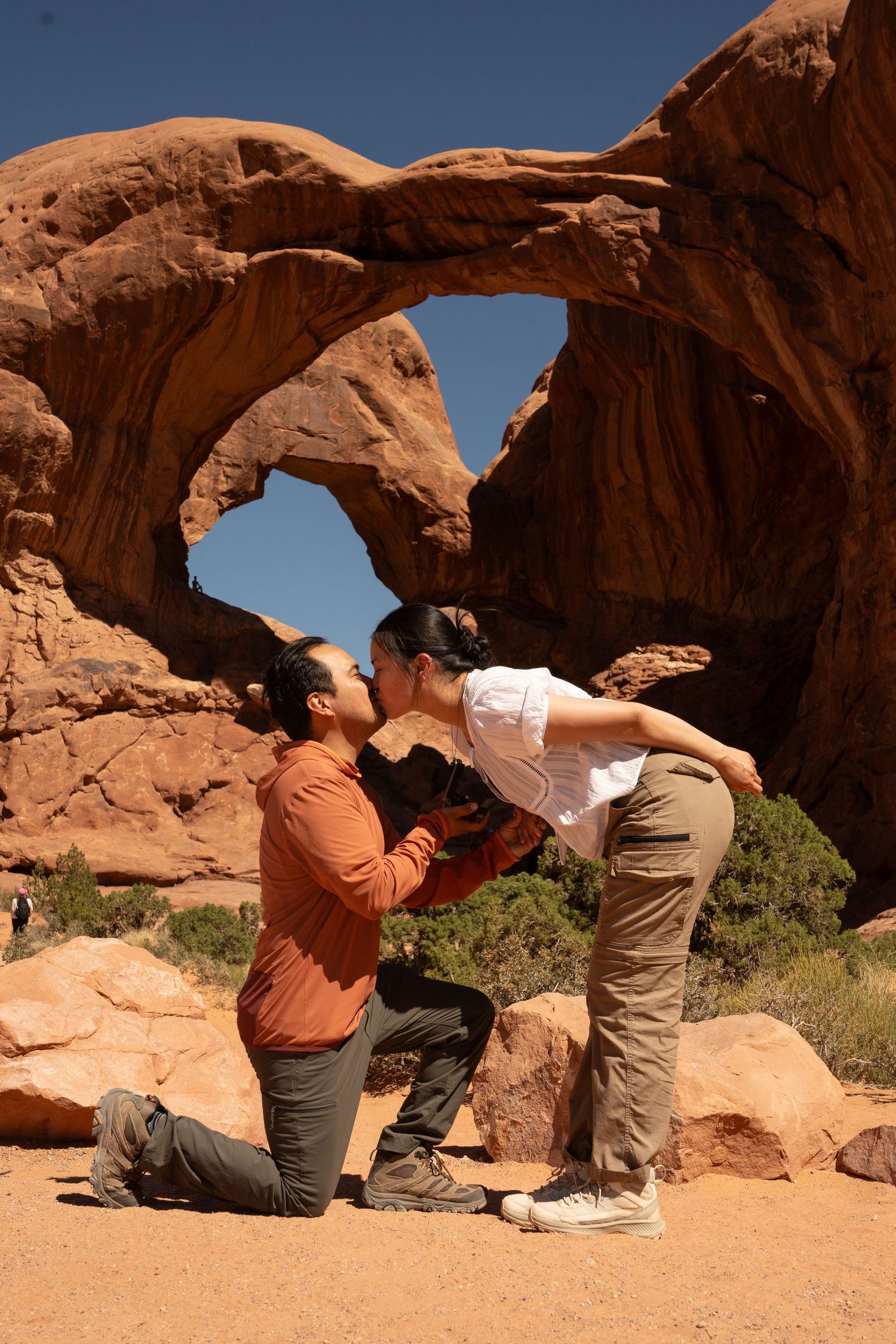
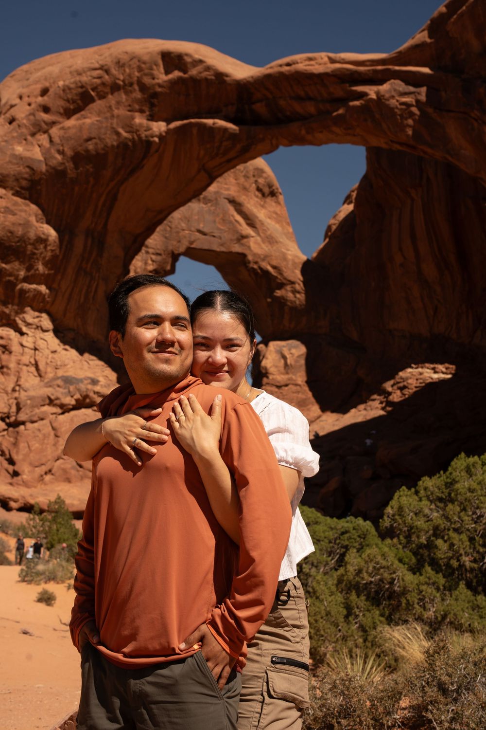
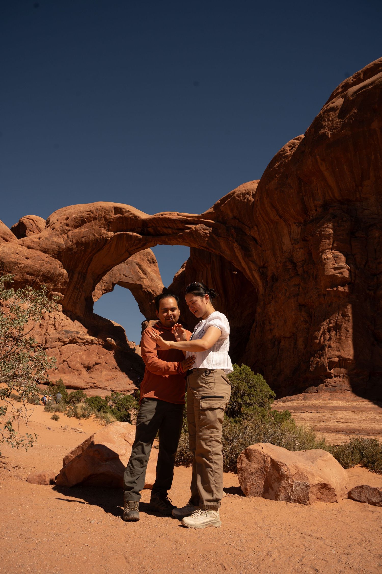
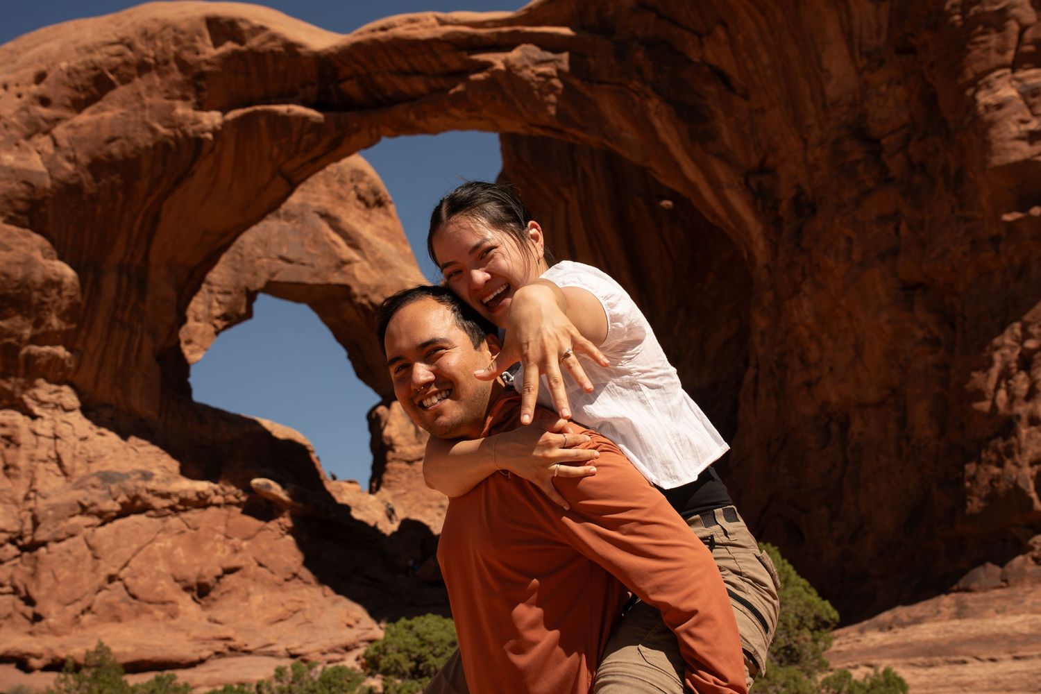
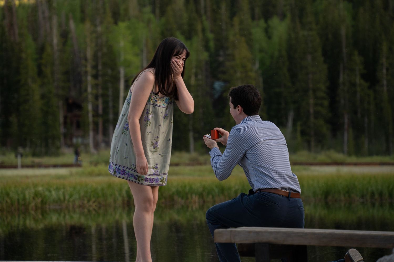
Aaron wanted Arches to look unmistakably like Arches: big and dramatic. He first considered Turret Arch, but the angles were trickier to shoot, so he switched to Double Arch for the bigger, cleaner frame. Lyna had no idea until the very last second. Read the full story of Aaron and Lyna’s Double Arch proposal.
Double Arch and the Windows are only two stops in a park with a lot more range. If you want the full breakdown, every arch worth considering, which ones to skip, and why I steer most couples away from Delicate Arch (more on that next), I’ve covered the whole breakdown in the complete guide to the best proposal spots in Arches.
Distance: Double Arch trailhead is an easy, mostly flat walk from the Windows parking lot.
Fee: $30/vehicle Arches entrance fee (as of this writing); no separate permit for a proposal.
Timed entry: Not required for 2026 as of a February 2026 NPS announcement; confirm on nps.gov before your trip.
Best time: Early morning or the last hour before close, when the Windows crowd thins out.
Delicate Arch: The One I Usually Talk Couples Out Of (and When I Don’t)
Delicate Arch is the one on the license plate, the single most photographed formation in Utah, and the spot almost every couple asks about first. It’s also the one I steer most couples away from for a proposal, though not always.
The hike itself is a serious commitment: about 3 miles round trip with roughly 480 feet of elevation gain, mostly exposed slickrock, and a narrow ledge for the final stretch. The National Park Service rates it difficult, and it earns that rating in the summer heat especially, there’s almost no shade the entire way.
The bigger issue for a proposal specifically is the crowd. Delicate Arch is one of the most popular hikes in the park, and it’s rare to get it to yourself, especially at sunset when everyone else has the same idea. Getting down on one knee in front of a packed viewpoint can turn an intimate moment into a performance for strangers, and that’s not what most couples are picturing when they imagine this.
If the audience doesn’t bother you, or you’re set on this specific arch no matter what, it’s still doable. I’d plan around sunrise instead of sunset (a noticeably smaller crowd shows up for it), and we’d work out a plan for getting a clean shot even with other hikers nearby. If you want a full breakdown of how I’d stage a Delicate Arch proposal, timing, positioning, working around the crowd, I’ve written that up separately in a dedicated guide to Delicate Arch proposal timing.
I haven’t documented a proposal at Delicate Arch myself, so I won’t put up a photo here that wasn’t taken at this exact spot. I know the trail well from scouting it, and I’m glad to plan one if this specific arch is the look you’re set on, I’d just rather tell you the tradeoffs upfront than let you find them out on the trail.
Distance: ~3 miles round trip, ~480 ft elevation gain, rated difficult by the NPS.
Crowds: Consistently one of the busiest hikes in the park, especially at sunset.
If you go anyway: Sunrise draws a noticeably smaller crowd than sunset.
Photos on this page: None yet; I haven’t documented a proposal here, and I won’t pass off a stand-in as if it were taken here.
Dead Horse Point & Canyonlands: The Big Overlook Option
If your partner’s dream shot is a sheer drop into a canyon carved by the Colorado River, this is where you go, not Arches.
Dead Horse Point State Park sits on a mesa with a nearly 2,000-foot overlook straight down into a gooseneck bend of the Colorado River, with Canyonlands National Park’s Island in the Sky district spread out beyond it. It’s a short, flat walk from the parking area to the main overlook, so this is a strong option if your partner isn’t up for a long hike.
The park charges a $20 day-use fee per vehicle (up to 8 people), $15 for Utah seniors 65+, $10 for motorcycles, or $10 per group of up to 4 walk-ins or cyclists. Here’s the detail that trips people up: a Special Use Permit is required for any wedding or ceremony at Dead Horse Point, but a proposal isn’t a ceremony. You don’t need that permit, just the standard day-use fee.
Canyonlands National Park’s Island in the Sky district sits right next door and runs on national park rules instead: a $30 vehicle entrance fee, no timed-entry requirement, and no permit needed for a proposal (same as Arches, permits only apply to weddings). Mesa Arch, one of the park’s signature spots, is famous for framing sunrise through the arch itself, though be ready to share that specific view: it draws a dedicated crowd of photographers before dawn.
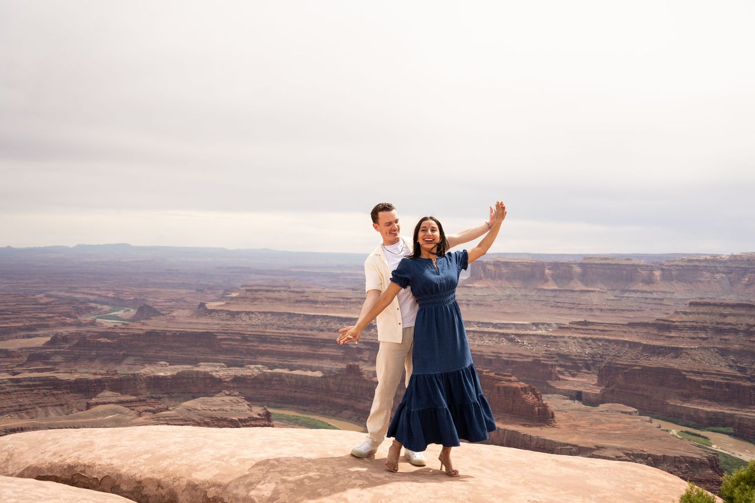
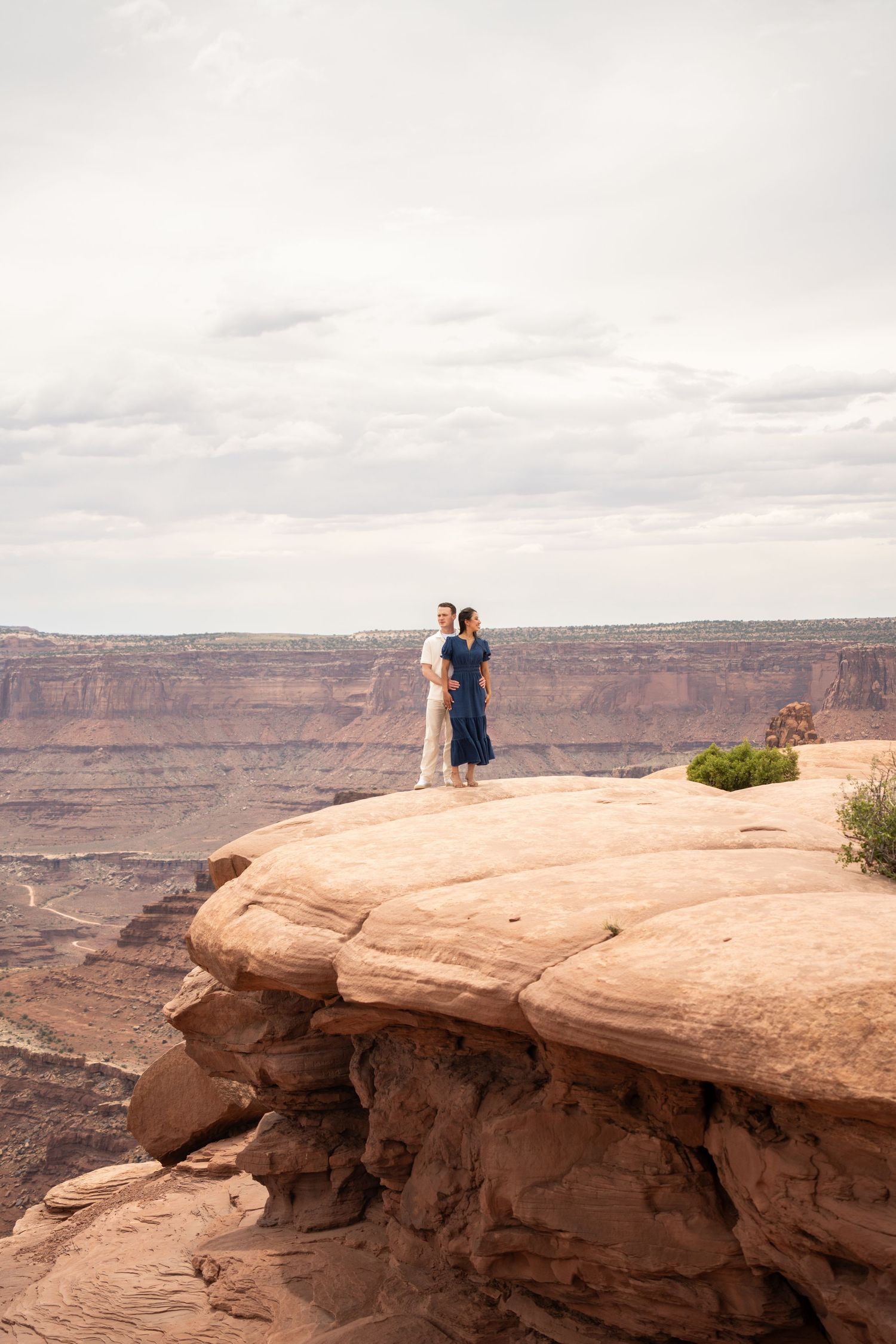
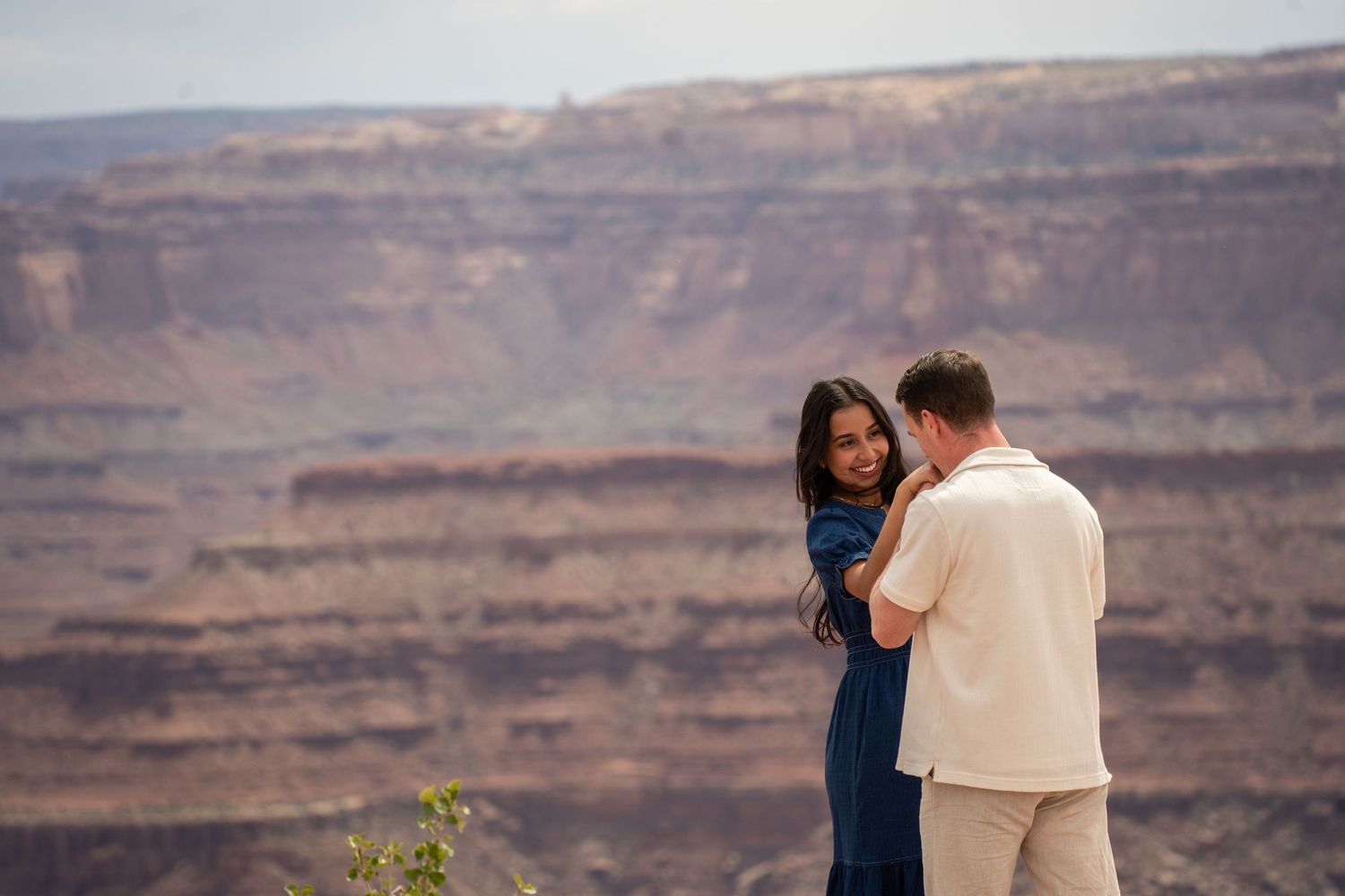
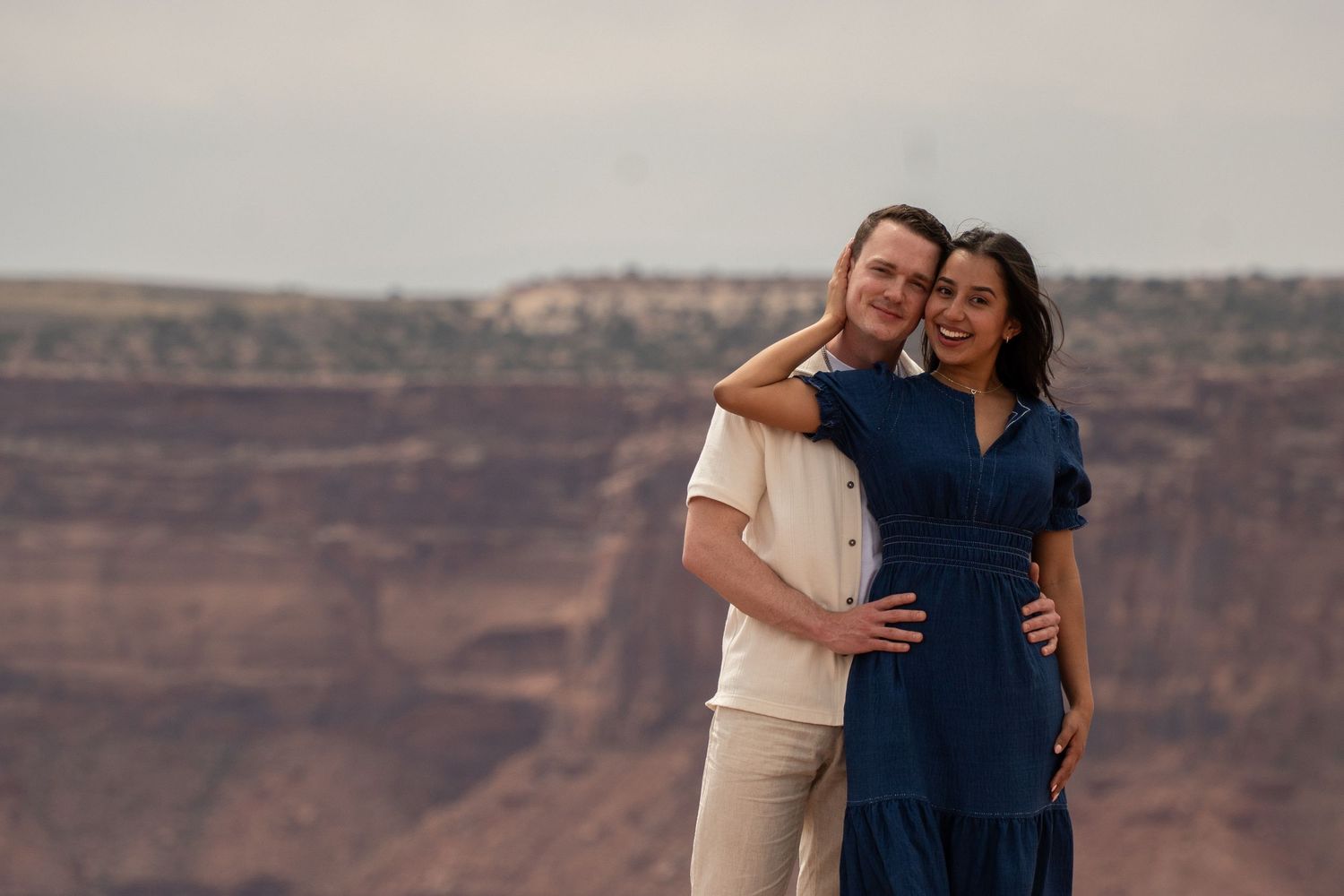
These photos aren’t staged, but I want to be upfront about what they show: they’re from Luke and Karen’s elopement at Dead Horse Point overlooking Canyonlands, not a proposal. I’d love to document your proposal here next.
Because Canyonlands and Dead Horse Point deserve their own deep dive, permits, ceremony sites, every overlook worth considering, I’ve built that out in full on the dedicated Canyonlands proposal photographer page. Start there if this is the option you’re leaning toward.
Dead Horse Point fee: $20/vehicle (up to 8 people); $15 UT seniors 65+; $10 motorcycle.
Permit: Only required for a wedding/ceremony, not a proposal.
Canyonlands (Island in the Sky) fee: $30/vehicle; no permit needed for a proposal.
Best known spot: Mesa Arch at sunrise, though expect company.
Fisher Towers: For Couples Who Want an Adventure Built In
Fisher Towers is the spot for a couple who wants the hike itself to be part of the story, not just the backdrop at the end of it.
The towers sit about 20 miles northeast of Moab off Highway 128, the scenic route that follows the Colorado River instead of the highway through town. The trail loops roughly 4.5 to 5 miles around the base of the towers, with about 1,300 feet of elevation gain, a six-step metal ladder down into a canyon along the way, and close-up views of the Titan, the tallest freestanding sandstone spire on Earth. It’s Bureau of Land Management land, so there’s no fee and no permit process for a proposal, same as Corona Arch.
This is a distinctly different kind of red rock than Arches or Corona Arch: instead of a clean arch or a smooth overlook, you get jagged, almost otherworldly spires that look like something out of a different planet. It photographs dramatically different from anywhere else on this page, which is why some couples choose it.
Plan for a half-day commitment here, not an hour. The elevation gain and the ladder section mean this isn’t the spot for a partner who isn’t already an active hiker, and there’s no water source anywhere on the trail, so pack more than you think you need.
I don’t have a documented proposal from Fisher Towers on this page yet. I’ve scouted the trail and I know it well enough to plan an actual proposal there, I just haven’t had a couple choose it yet. If the idea of proposing surrounded by the strangest rock formations in Moab appeals to you more than a classic arch, tell me, and let’s be among the first.
Distance: Roughly 4.5–5 miles round trip loop, ~1,300 ft elevation gain.
Land & permit: BLM land, no fee, no permit needed for a proposal.
Access: About 20 miles northeast of Moab via Highway 128 (the Colorado River scenic route).
Photos on this page: None yet; I know the trail from scouting it, not yet from a documented proposal there.
Potash Road: River Views Without a Hike
If your partner wants the Colorado River in the photo and has zero interest in a trail, Potash Road is the answer.
Officially the Potash-Lower Colorado River Scenic Byway (Utah Route 279), it’s a paved 17-mile road that traces the river between sheer sandstone walls locals call Wall Street, popular with rock climbers for a reason. It starts about 4 miles north of Moab off Highway 191 and ends at the Potash boat ramp, with pull-offs along the way for the Moab Valley overlook, petroglyphs, dinosaur tracks, and two more arches, Bow Tie and Jug Handle, beyond the Corona Arch trailhead that starts along the same road.
Since it’s a drive-up option on BLM land, there’s no fee, no permit, and no hike required at all if that’s what your partner needs. That also makes it one of the more flexible spots on this page for a couple working with an unpredictable schedule, a bad knee, or just a short window between other plans.
The tradeoff is privacy: it’s a public road with regular traffic, especially climbers heading to the crags along Wall Street, so a pull-off proposal isn’t as isolated as a mile into a desert trail. Early morning is your best window, both for the light on the canyon walls and for having a pull-off mostly to yourselves.
I don’t have a documented proposal from a Potash Road pull-off yet, separate from the Corona Arch trailhead that sits along the same road. If a river view without any hiking is what you’re picturing, let’s talk about which pull-off gives you the best combination of light and privacy for your dates.
Distance: Zero hiking required; multiple roadside pull-offs along a 17-mile paved road.
Land & permit: BLM-managed scenic byway (UT-279); no fee, no permit.
Best time: Early morning, for both the light and lighter traffic.
Along the way: Corona Arch trailhead, Bow Tie Arch, Jug Handle Arch, and Colorado River views.
The La Sal Mountains: The Cool-Weather Option
When Moab’s desert floor is pushing 100°F, the La Sal Mountains are sitting 30, sometimes 40 degrees cooler, fifteen minutes away.
The La Sal Mountain Loop Road is a 60-mile paved scenic drive that starts about 6 miles south of Moab off Highway 191 and climbs into the Manti-La Sal National Forest. Near the top of the climb, an overlook around 8,300 feet gives you a sweeping view back over the red rock desert below, with Canyonlands and the surrounding mesas visible in the distance, evergreens and alpine meadows framing you on one side, and the whole desert spread out on the other. Another well-known pull-off looks out toward Castleton Tower, one of the more striking spires in the area.
This is the spot for a couple who wants a different look than every other red-rock proposal photo out there, mountain meadow meeting desert basin in the same frame, or who’s visiting in peak summer and wants an actual escape from the heat for the moment itself. It’s also a legitimate option if a long desert hike isn’t realistic for your partner. Most of the best viewpoints are pull-offs right off the road.
There’s a defined seasonal window here: June through October is when the road is reliably clear and the wildflowers and meadows are at their best. Snow closes sections of the loop in winter, so this isn’t a year-round option the way most of the spots on this page are.
I haven’t documented a proposal in the La Sal Mountains yet. If the idea of pairing alpine and desert in the same trip, or just escaping a brutal July afternoon, sounds right for you, this is worth a proper conversation before you rule it out in favor of the more obvious desert spots.
Access: La Sal Mountain Loop Road, starting ~6 miles south of Moab off Highway 191.
Elevation: Main overlook sits around 8,300 ft, dramatically cooler than the desert floor.
Season: Reliably open June through October; snow closes sections in winter.
Fee/permit: None; mostly roadside pull-offs, no hike required for the main viewpoints.
Moab Rim: The Panoramic Valley View
Moab Rim gives you the view that puts the whole trip in context: the Moab Valley, Arches National Park, and the La Sal Mountains, all from one overlook.
It’s better known as a serious 4x4 trail, which throws people off, but it’s also a legitimate hike. From the trailhead off Kane Creek Boulevard, about 2.6 miles from Highway 191, the route climbs steadily to a viewpoint at roughly 1.4 miles in. It’s steep and exposed the whole way, with no water source anywhere along the trail, so this one leans toward couples who are already comfortable hikers.
Because it’s also an active Jeep trail, you’ll likely share it with off-road vehicles heading up or down, which is worth knowing if total seclusion is the priority. What you get in return is one of the widest, most complete views of the Moab area available from any single spot on this page.
It’s BLM land, so the same rule applies here as Corona Arch and Fisher Towers: no fee, no permit process, no wait between deciding on this spot and booking it.
I haven’t photographed a proposal at Moab Rim yet. If a sweeping, take-in-the-whole-trip view matters more to you than a single dramatic formation, it’s worth a closer look before you default to Corona Arch just because it’s the one everyone’s heard of.
Distance: ~1.4 miles to the main viewpoint, steep and exposed.
Access: Trailhead off Kane Creek Blvd, ~2.6 miles from Highway 191.
Shared use: Also an active 4x4/Jeep trail; expect some vehicle traffic.
Land & permit: BLM land, no fee, no permit.
Found Your Spot? Let’s Lock In the Timing
Once you know which of these eight fits you, the next call is timing: season, sunrise or sunset, and the cover story that gets you there without a hitch. I’ll help you work all three out.
Best Time of Year to Propose in Moab, Month by Month
Moab’s desert heat is the main planning factor here, more than the label on the season. Here’s how each month plays out, so you can match your travel dates to the experience you want instead of guessing from a generic “spring and fall are best” answer.
January: Cold, quiet, and often beautiful if a light dusting of snow hits the red rock. Daytime highs hover around 41°F, nights drop well below freezing. Trails are close to empty. If privacy matters more to you than comfort, this is one of the best-kept-secret months in Moab, just dress for actual winter and expect some icy sections on shaded trails.
February: Similar to January but starting to warm, daytime highs around 50°F. Still quiet, still cold at night. A solid month if you want winter’s privacy without quite as much bite, though pack layers regardless.
March: Highs climb into the low 60s, and Moab starts waking up. Easter Jeep Safari, one of the biggest off-road events in the country, typically lands in Moab this month and fills the town with off-roaders, which affects lodging availability more than trail crowds. Book your stay early if your trip overlaps with it, and check the current dates before you lock in.
April: One of the two truly ideal months. Highs around 70°F, comfortable hiking temperatures, and wildflowers starting to show up on some trails. It’s also peak spring-break season, so the popular spots (Delicate Arch, Double Arch, Corona Arch) get busy midday. Sunrise and sunset timing matters more here than almost any other month.
May: Highs push into the upper 70s, and 100°F days can start showing up by the end of the month. Still comfortable for most of the day if you avoid midday. Crowds are heavy, this is one of Moab’s busiest windows, so plan spots and timing carefully if privacy matters.
June: Highs average around 91°F, with plenty of afternoons well past 100°F. This is where sunrise and the last hour before sunset stop being a preference and become a requirement. Trails thin out fast after 10am. If you’re set on a summer trip, build the whole day around avoiding the heat.
July: The hottest month, average highs around 97°F, and about half of July’s days regularly hit 100°F or more. This is peak heat, not peak comfort. A pre-dawn start for a hike-in spot, or an evening session at a drive-up location like Potash Road, are your best options.
August: Still brutally hot, highs around 93°F, but starting to ease slightly by the back half of the month. Same rules as July apply: sunrise or the final hour before sunset only. Afternoon monsoon storms become more common, which can make for dramatic sky photos if timed right and safely.
September: The other truly ideal month. Highs drop to a comfortable 86°F early in the month and keep falling, crowds ease off after Labor Day, and the light turns noticeably softer. If your travel dates are flexible, this is one of the two best windows on the calendar.
October: Highs around 70°F, similar comfort to April but with fall color starting to show in the cottonwoods along the rivers. Crowds are lighter than spring. This is widely considered one of Moab’s best all-around months, comfortable temperatures, manageable crowds, and excellent light.
November: Highs drop to around 55°F, and the crowds thin out fast after the first couple weeks. A quiet month if you want the desert closer to yourselves, with mild enough weather that a coat handles it.
December: Cold and quiet again, highs around 41°F, similar to January. Holiday week can bring a small crowd bump, but otherwise this is one of the emptiest stretches of the year on the trails, good news if seclusion is the priority and you don’t mind the cold.
How to Plan Your Moab Proposal: My 3-Step Process
Planning a Moab proposal from out of state doesn’t have to mean months of research. Here’s how it works once you reach out, broken into the three concrete decisions that matter: where, when, and how we keep it a surprise.
Step 1
Tell Me Your Dates and Your Vision
Once you know your travel window, that’s the only piece I need from you to start. Tell me what you’re picturing, hike or no hike, big classic arch or a quieter overlook, total privacy or you don’t mind company, and your fitness level as a couple. I’ll match that to the spots on this page that fit. If your dates overlap with a busy stretch, I’ll flag it and we’ll adjust timing accordingly.
Step 2
We Build Your Cover Story and Lock In Timing
Every successful surprise needs a believable reason to be at the right spot at the right time. We work that out together, a hike you’d want to do anyway, a “quick stop” on a longer scenic drive, whatever fits how you two travel. Then we lock in sunrise or sunset timing around your specific spot, since getting this wrong is the single biggest reason a proposal photo doesn’t turn out the way a couple pictured it.
Step 3
I Scout Ahead, Then Disappear Into the Trail
I hike up before you arrive, so I’m already in position, blended in like just another hiker or photographer, well before you get close. I shoot from a distance with a long lens until the moment happens, then move in for the reaction shots right after. You focus on your partner. I handle staying invisible until it’s over.
What to Expect on Proposal Day
Here’s the full timeline of a Moab proposal day, start to finish, so nothing on the actual day catches you off guard.
HOUR −1
Already in Position
I’m on the trail before you leave your hotel, set up somewhere with a clean sightline to your spot, camera ready, blending into the scenery like any other hiker with a camera. If the plan calls for a specific angle at Corona Arch’s cable section or a spot near Double Arch, I’ve already found it and I’m waiting there.
ARRIVAL
You Show Up, Cover Story Intact
You walk up just like you would on any other hike or scenic stop, whatever cover story we built together. I stay far enough back that your partner has zero reason to suspect a photographer nearby is there for you specifically. This is where the groundwork from planning pays off.
THE MOMENT
Down on One Knee
This is the only part I can’t script, and it shouldn’t be scripted. I shoot continuously through the moment itself with a longer lens from a distance, so I capture the actual reaction, not a recreated one. Once you’re both up and celebrating, I move in closer for the ring shots and the two of you together.
AFTER
Celebration Photos, Same Session
Once the shock wears off, we shoot celebratory portraits: the ring, the two of you against the view you just got engaged in front of, whatever you want to do next. If you’re popping champagne or planning a bigger moment right after, this is when it happens, and I’m still rolling.
Getting to Moab, Where to Stay & Eat, and What to Budget
Getting There
Moab doesn’t have major commercial air service, so most out-of-state couples drive in. Salt Lake City International Airport is the closest major airport, but it’s a long haul: about 324 miles and 4.5 hours by car. Grand Junction Regional Airport in Colorado is the faster option for a lot of routes, about 100 miles and 2 hours of driving. If you’d rather skip the drive entirely, Canyonlands Field Airport (CNY), about 18 miles north of town, has had direct flights from Salt Lake City and Denver through smaller carriers, worth checking directly since regional flight schedules change often.
However you get here, build in buffer time. This isn’t a spot you fly into the morning of and propose that afternoon; between the drive or the connection, plus needing rest before an early sunrise session, plan at least one full night in town before your proposal day.
Where to Stay
Most lodging clusters along Main Street (Highway 191). Staying on the north end puts you 5 to 10 minutes from the Arches entrance, useful if your spot is Double Arch or Delicate Arch and you want to beat the day-trip crowd in. Staying downtown puts restaurants, outfitters, and the visitor center within walking distance, which matters more if Corona Arch, Potash Road, or Moab Rim (all southwest of town) are your spot. The south end of Highway 191 tends to run a little cheaper and a little quieter than downtown.
If you want something more memorable than a standard hotel room for the trip itself, a handful of properties lean into the setting, think Colorado River views, historic ranch grounds, or a private balcony facing red rock. Whatever you book, reserve early if your dates land anywhere near Easter Jeep Safari (typically March or April) or a summer holiday weekend; those windows sell out fast.
Where to Eat
Moab’s food scene punches above its weight for a town this size. Milt’s Stop & Eat has been serving burgers and hand-spun shakes from a roadside stand since 1954, a beloved local institution worth the stop before or after a hike. For something more substantial after your proposal, Antica Forma (wood-fired Neapolitan pizza) and Pasta Jay’s (Italian, around for decades) both work well for a celebration dinner. Fiesta Mexicana is the local favorite for Mexican food, and Sabaku Sushi is the surprise standout if you want something completely different from red rock and burgers. If you’re planning a celebratory meal right after the proposal, book ahead, especially in peak season, small-town restaurants fill up fast on a Friday or Saturday night.
Budget Considerations
Beyond the photography itself, plan for: a park entrance fee if your spot is inside Arches or Canyonlands ($30/vehicle, covers your whole group for the visit); the Dead Horse Point day-use fee if that’s your spot ($20/vehicle); lodging, which swings widely by season (expect summer and Easter Jeep Safari weekend rates well above a quiet November night); gas for driving in, especially from Salt Lake City; and a celebration meal or activity afterward if you’re building that into the day. None of Moab’s BLM spots, Corona Arch, Fisher Towers, Potash Road, Moab Rim, add any fee or permit cost on top of your trip. Your biggest actual line item beyond the trip itself is the photography, and that’s the one piece I can give you an exact number on before you book anything.
Your Trip Window Is the Only Deadline That Matters Here
No permit office, no application to wait on, for almost every spot on this page. The only limiting factor is my calendar, especially for a summer sunrise or sunset slot. Reach out as soon as your dates are set.
Sturdy shoes matter more than a nice outfit here. Every spot on this page crosses loose sand, slickrock, or both, and a flat sandal or a heel will make the hike miserable and the photos worse. A supportive sneaker or a light hiking shoe works for nearly every trail here; save the dressier shoes for the celebration dinner after.
Water matters more than people expect, even for a short walk. Desert air pulls moisture out of you faster than it feels like at the time, especially above 80°F. Bring more than you think you need, and bring extra if your spot is Fisher Towers or Moab Rim, neither has a water source anywhere on the trail.
Sun protection is non-negotiable for anything outside the shoulder-season months: most of these spots offer little to no shade. A hat, sunscreen, and sunglasses cost you nothing in the photos and save you a bad sunburn.
If you’re timing the shoot around sunrise or sunset, which most of these spots call for, bring a light layer too. Desert temperatures swing hard once the sun’s off the rock, even on a hot day; a 95°F afternoon can drop 30 degrees by an hour after sunset.
For a winter trip, add proper layers: a warm coat, gloves, and traction if you’re headed anywhere with shaded, icy sections. Camera batteries handle cold just fine on my end; it’s usually the couple’s fingers that struggle first, so hand warmers are worth the extra ounce in your bag.
One more note: if a ring is coming with you, decide now who’s carrying it and how. A zipped inner pocket beats a loose one every time.
Which Moab Proposal Spot Fits You?
Eight options is a lot to compare from your couch. Here’s the short version: match your priority in the left column to the spot that delivers it.
If you want…
Best spot
Effort
Fee/Permit
The classic red-rock-arch photo, no permit hassle
Corona Arch
Moderate, ~3 mi
None
A big national-park arch with minimal walking
Windows / Double Arch
Easy, short walk
$30 entrance
The single most iconic formation in Utah
Delicate Arch
Difficult, ~3 mi
$30 entrance
A sheer canyon overlook, little to no hike
Dead Horse Point
Easy
$20 day-use
Sunrise drama and a national park backdrop
Canyonlands (Mesa Arch)
Easy–moderate
$30 entrance
A serious hike and dramatic, unusual rock spires
Fisher Towers
Difficult, ~5 mi
None
River views with zero hiking
Potash Road
None
None
Cooler temps and mountain scenery
La Sal Mountains
None–easy
None
A sweeping panoramic view of the whole valley
Moab Rim
Difficult, ~1.4 mi
None
Still not sure? A few patterns from couples I’ve worked with: the adventurous pair who already has hiking as part of every vacation usually ends up at Fisher Towers or Corona Arch. The couple who wants the photo to look unmistakably like a national park chooses Double Arch or Mesa Arch. The couple traveling with an injury, a pregnancy, or just not much time in the day goes for Dead Horse Point or Potash Road. And more couples than you’d expect end up choosing the La Sal Mountains specifically because it’s the one option nobody else’s Pinterest board has.
Permits & Legal: The Full Breakdown by Land Manager
Here’s the section most guides bury in fine print halfway down the page. I’m putting it up front and making it simple. The short version: nothing on this page requires a permit for a proposal. Permits only enter the picture for a formal wedding ceremony, and even then, only at a few of these spots.
Spot
Land manager
Entrance fee
Permit for proposal
Permit for ceremony/wedding
Corona Arch
BLM
None
None
None
Windows / Double Arch
NPS (Arches)
$30/vehicle
None
Special Use Permit
Delicate Arch
NPS (Arches)
$30/vehicle
None
Special Use Permit
Dead Horse Point
Utah State Parks
$20/vehicle
None
Special Use Permit
Canyonlands (Island in the Sky)
NPS
$30/vehicle
None
Special Use Permit (~$185)
Fisher Towers
BLM
None
None
None
Potash Road
BLM
None
None
None
La Sal Mountains
Manti-La Sal National Forest
None
None
Check current USFS rules
Moab Rim
BLM
None
None
None
The pattern here is simple once you see it laid out: BLM land (Corona Arch, Fisher Towers, Potash Road, Moab Rim) has essentially zero red tape for a proposal or a proposal photo shoot. National park land (Arches, Canyonlands) charges an entrance fee but needs no permit for a proposal specifically, only for an actual ceremony. Dead Horse Point runs the same way: pay the day-use fee, skip the permit, unless you’re planning a full ceremony there. If your plans do call for an actual wedding ceremony at any of these spots down the road, that’s a different, more involved process than what this page covers, worth its own conversation once you get there. Fees and permit rules change over time, so double-check current details on the relevant agency’s website before you travel, and I’m always glad to help you sort out the current rules for your exact spot and date.
Why Book Someone Who Already Knows Moab
No permit office to wait on. Most of Moab’s best spots sit on BLM land, so your booking timeline runs on my calendar and your travel dates, not a government turnaround time.
Scouted, not guessed. I’ve hiked every trail on this page, several more than once, in more than one season, so the spot I recommend is based on what works, not what has the most tagged photos.
A cover story, built together. I help you construct a reason to be at the right spot at the right time that your partner will believe, then I disappear into the trail until you’re ready.
Local knowledge you can’t get from a blog post. Which trailhead fills up by 8am, which overlook holds golden hour longest, which spot to skip entirely on a given day. That comes from being here, repeatedly, not from a single scouting trip.
One quote, no surprises. Travel to Moab is factored into your number upfront, on a planning call before you book anything, not added as a surprise line item afterward.
Moab Proposal Photos
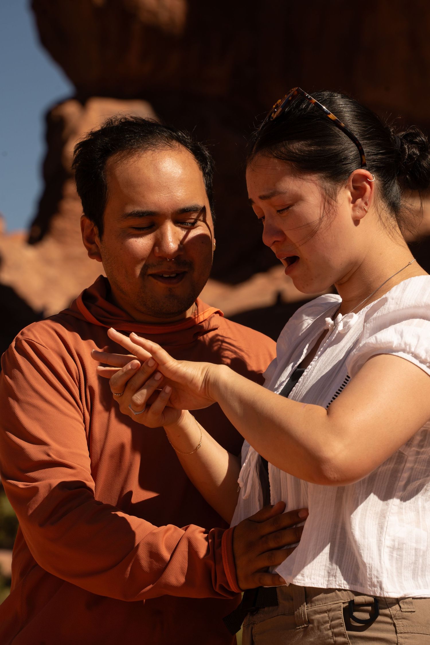
Proposals I’ve photographed in Moab, including Jacob and Rae’s Corona Arch proposal and Aaron and Lyna’s Double Arch proposal, both told in full below.
Jacob & Rae’s Corona Arch Proposal
Jacob planned his Corona Arch proposal two weeks out, during a trip from the Midwest. Rae had no idea until they were already on the trail. Read the full story of Jacob and Rae’s Corona Arch proposal.
Aaron & Lyna’s Double Arch Proposal, Just Up the Road
Aaron wanted Arches to look unmistakably like Arches: big and dramatic. He first considered Turret Arch, but the angles were trickier to shoot, so he switched to Double Arch for the bigger, cleaner frame. The cover story was two film cameras and a few bird photos on the trail. Lyna had no idea until the very last second. Read the full story of Aaron and Lyna’s Double Arch proposal.
Ready to Plan Your Moab Proposal?
Tell me your travel dates and what you’re picturing. I’ll help you find the spot, the season, and the timing that fits, before you land in Moab, not after.
I’m Jade, a Utah-based proposal photographer, and Moab is one of my favorite places to work. I know which spots need a permit and which don’t, how the heat moves through the day, and how to blend into a busy trail until you’re ready. Corona Arch is the spot I shoot most, but Arches, Canyonlands, Fisher Towers, and the quieter spots on this page are all worth considering depending on what you and your partner want.
Proposal photography starts at $845, with travel added for Moab since it sits outside the standard hour-of-Wasatch-Front radius. You’ll have 40+ edited images and video within 24 hours. Extras like a hot air balloon add-on or help planning a bigger celebration afterward can be built into your package too, tell me what you’re picturing and we’ll work it into your quote.
Frequently Asked Questions About Moab Proposals
Is there a single pass that covers entrance fees to Arches, Canyonlands, and Dead Horse Point?
Partly. The America the Beautiful annual pass (around $80, verify the current price before you buy) covers entrance to every National Park Service fee site for a full year, including both Arches and Canyonlands. Dead Horse Point is a Utah State Park, a separate system, so that $20 day-use fee isn’t covered by the federal pass. If your trip includes both national parks and you’re the type to come back to Utah again, the annual pass pays for itself after two visits.
Can you keep a Moab proposal a surprise?
Yes, that’s one of my specialties. I typically shoot from 50 to well over 100 feet away with a long lens for the actual moment, far enough that most people on the trail assume I’m just another hiker or photographer working the same spot, not there for you specifically. I hike up ahead of your arrival and get positioned before you’re anywhere close, so there’s no scrambling or last-second setup that might tip off your partner.
How much does a Moab proposal photographer cost?
Utah proposal photography starts at $845 for a session within about an hour of the Wasatch Front. Moab sits well outside that radius, so travel is factored into your quote, along with any extras like a bigger celebration afterward or a hot air balloon add-on. One detail that surprises people: if your day includes more than one spot, say a sunrise session at Corona Arch and a celebration dinner reservation I help you plan, that doesn’t add a separate charge. It’s the same session, built around more of your day. I’ll work out your exact number with you on the planning call before you book anything.
How far in advance should I book a Moab proposal photographer?
As soon as you know your travel dates. Most spots on this page don’t come with a permit-office lead time, so the actual deadline is my calendar, not the park’s. Timing still varies by season: a summer Friday or Saturday sunrise slot, or anything overlapping Easter Jeep Safari in spring, is safer booked 2 to 3 months out. A quieter month like November or January usually still has room 2 to 4 weeks ahead.
How fast will we get our Moab proposal photos?
Within 24 hours. You’ll have 40+ edited images and video of the moment the next day, so you can share the news while it still feels brand new instead of waiting weeks to relive it.
Does it matter if I propose at Corona Arch on a weekday versus a weekend?
It matters more than most people expect. Corona Arch draws roughly 80,000 visitors a year, and nearly all of that traffic concentrates on weekend mornings and midday, spring through fall. A weekday sunrise or the last hour before sunset will consistently get you a quieter trail than the same time slot on a Saturday. If your travel dates give you any flexibility at all, shifting even one day earlier or later in the week can be the difference between having the arch mostly to yourselves and sharing it with a dozen other hikers.
Do I need a marriage license or any paperwork to propose in Moab?
No. A proposal isn’t a legal event, so there’s no license, permit, or paperwork tied to the moment itself. A marriage license only comes into play later, once you’re planning the wedding: in Utah, that’s issued by a county clerk’s office, with no waiting period between getting the license and getting married. None of that needs to happen before, during, or right after your Moab proposal.
What if the weather doesn’t cooperate on the one day I have in Moab?
This is where Moab’s lack of permits works in your favor. If a wedding ceremony required a Special Use Permit tied to one specific date and location, bad weather would be an actual problem. A proposal doesn’t work that way here. If sunrise at Corona Arch looks rained out, we can shift to a different window the same day, or pivot to a spot that handles overcast light better, without needing anyone’s approval to change plans.
Can we do engagement or celebration photos in the same Moab session as the proposal?
Yes, and most couples end up doing this without planning to. Once the initial shock wears off, we naturally roll into a short set of celebration portraits: the ring, the two of you together, the view you just got engaged in front of. Since I’m already there and the light’s usually still good, there’s no need to book a second session or plan a separate trip back to Moab just for engagement photos.
Which Moab spots work best if family or friends want to hide nearby for the reveal?
Open overlooks work better than narrow trail sections for this. Dead Horse Point and the Canyonlands overlooks give a hidden group enough room to hang back at a distance without being obvious, since the viewpoint area is wide and often has multiple vantage points. Corona Arch is trickier: the cable-assisted ledge section narrows the trail enough that a group trying to stay hidden can end up more conspicuous, not less. If a surprise reveal with loved ones nearby is part of your plan, tell me early so we can pick a spot with enough space to pull it off.
Is Moab too far from Salt Lake City to visit and propose in the same day?
Technically it’s possible (about 4.5 hours each way), but I wouldn’t recommend it for a proposal specifically. You want to be rested and present for the moment, not road-weary from 9 hours of driving on the same day you’re planning to get down on one knee. Nearly every couple I’ve worked with in Moab builds in at least one overnight, arriving the evening before and shooting the next morning, which also gives you a buffer if weather or timing shifts.
Written by
Jade Jarvis
Utah-based wedding, elopement, and proposal photographer since 2025. I’ve scouted these locations myself, so the advice here comes from firsthand experience, not guesswork.